Consultancy
Environmental and natural resource management, grounded in practical field work.
GAB combines commercial farming experience, GIS and satellite monitoring, community engagement, and project discipline to support practical environmental and climate-smart work in Ghana.
Discuss a Consultancy ProjectServices
Practical services for land, climate, community, and agribusiness work.
Environmental & Natural Resource Management
Baseline studies, sustainability planning, resource-use planning, field reporting, and practical environmental systems for Ghanaian projects.
GIS, Drone & Satellite Monitoring
Spatial mapping, farm and land mapping, vegetation monitoring, drone survey planning, and satellite-backed reporting.
Blue Carbon MRV
Measurement, reporting, and verification support for mangrove, wetland, and coastal ecosystem work where site work must be clear and traceable.
FPIC & Community Engagement
Stakeholder mapping, consent pathways, community meeting documentation, and responsible engagement workflows for land and climate projects.
Agribusiness Systems Advisory
Commercial farming systems, buyer readiness, operating models, block-level planning, and risk-aware project delivery.
Project, Risk & Business Analysis
Structured planning, risk registers, performance analysis, delivery governance, and practical documentation for partners and clients.
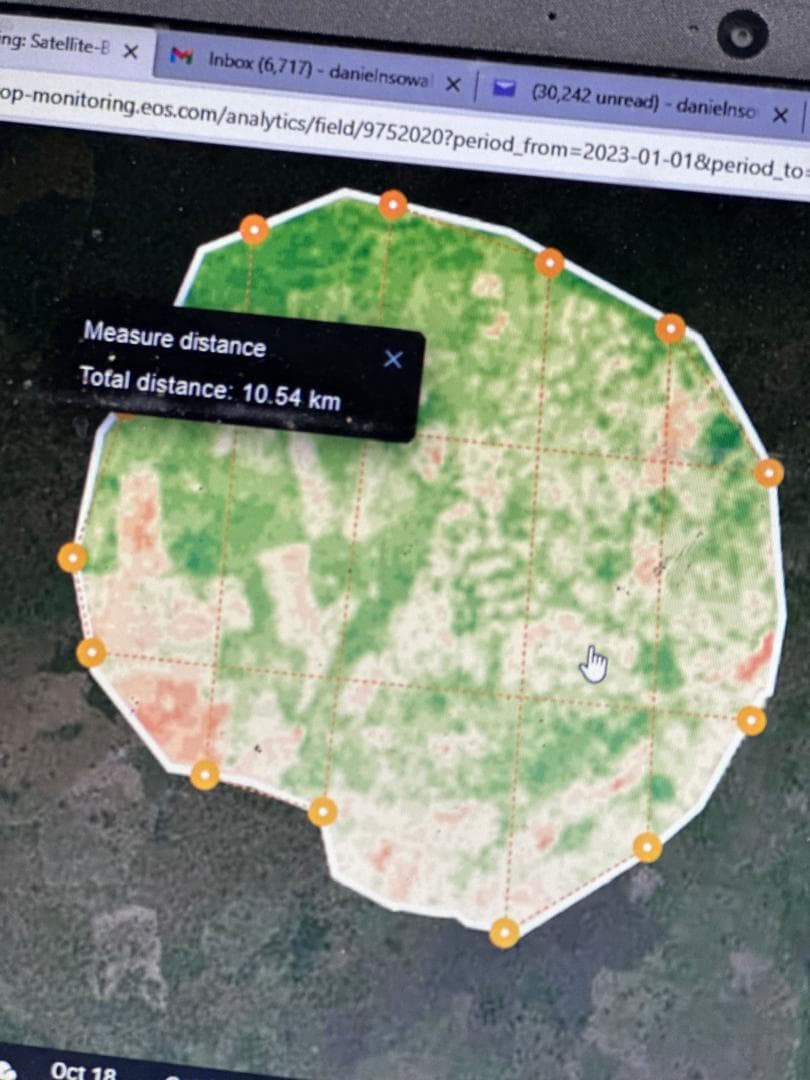
EOSDA boundary monitoring
Satellite monitoring supports farm planning, crop observation, and consultancy delivery.
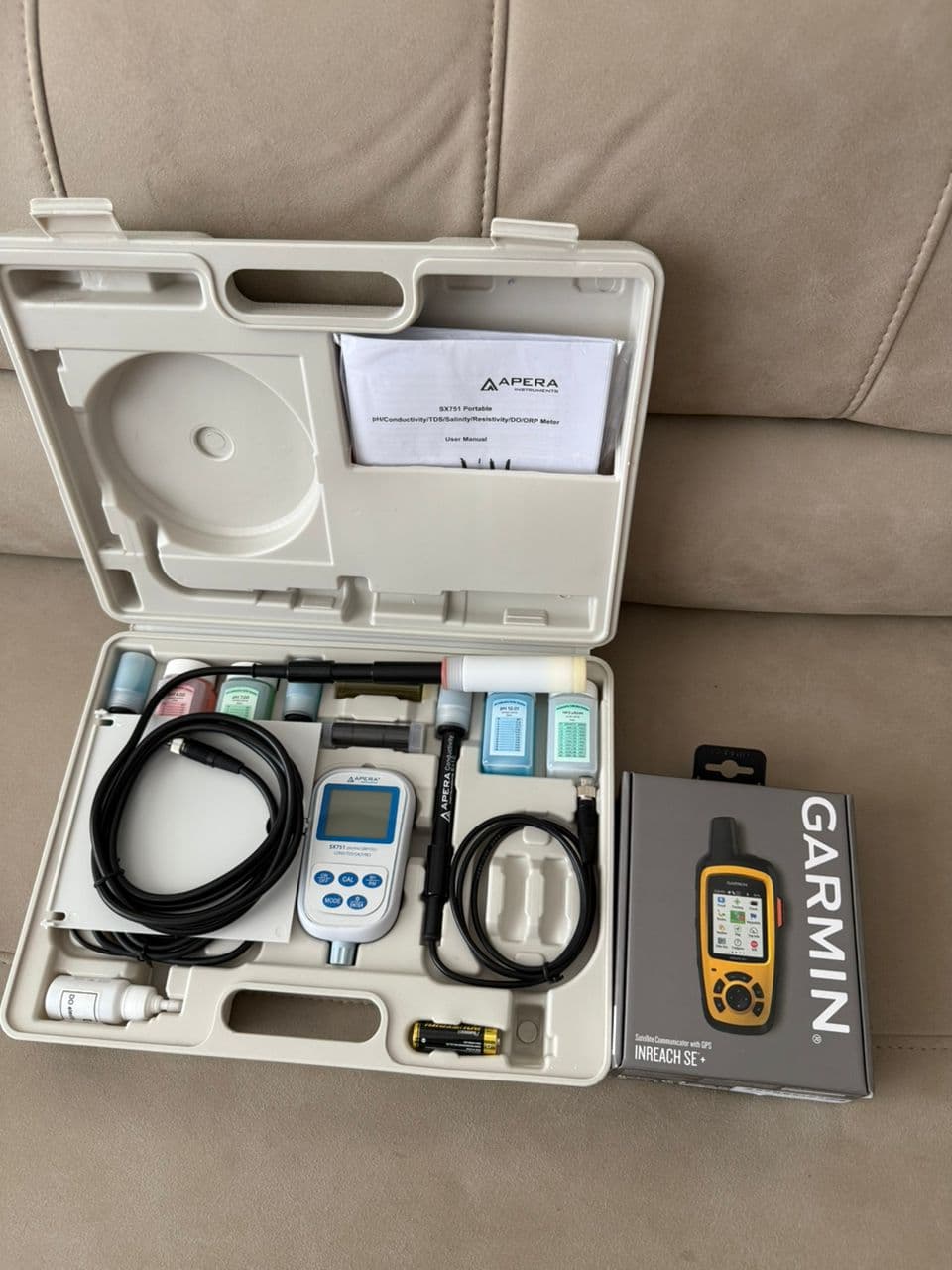
Soil sampler and GPS kit
Field equipment supports disciplined sampling, mapping, and site-level environmental assessment.
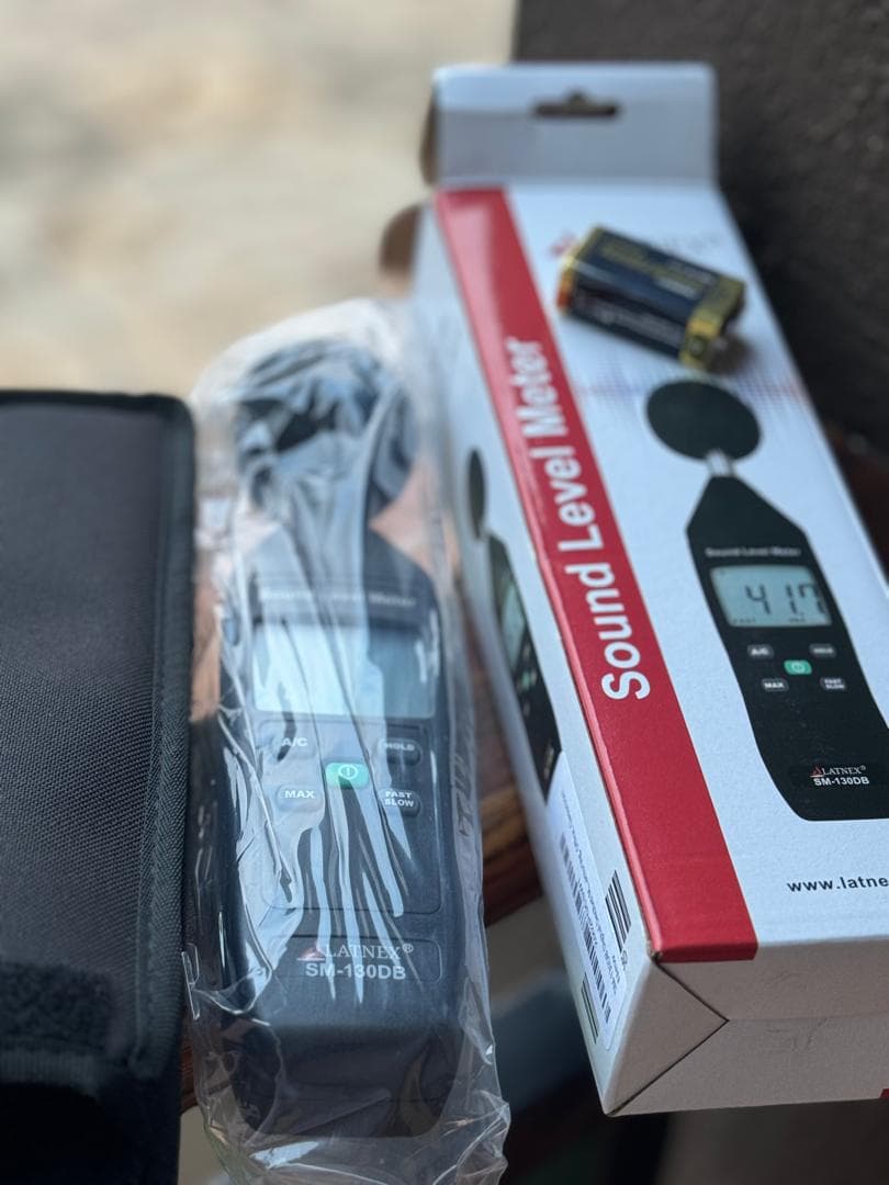
Air quality monitoring kit
Monitoring equipment extends GAB work into measurable environmental assessment.
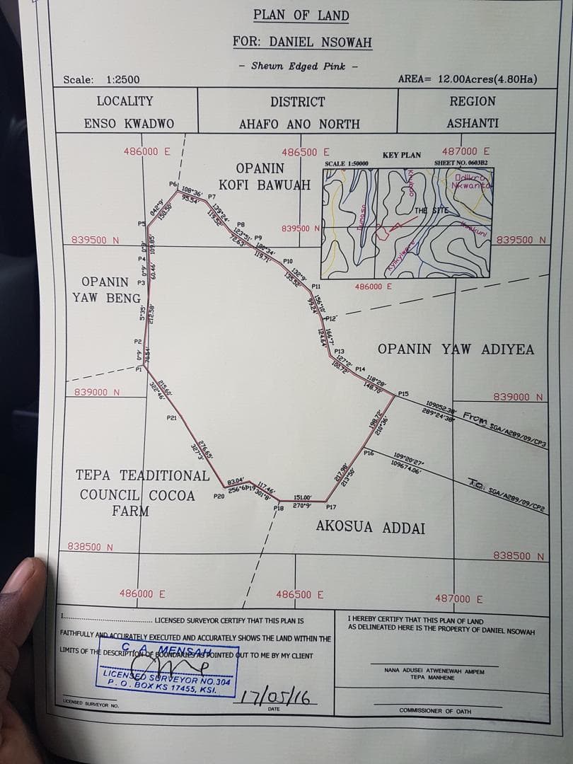
Mapped land assessment
Mapped land records support due diligence, site assessment, and clearer project documentation.
Selected Work Areas
Practical support for land, climate, and natural-resource decisions.
Satellite monitoring setup
Mapped boundaries, vegetation signals, and field observations can be brought together for land and crop monitoring.
Community engagement support
Stakeholder conversations, consent pathways, and meeting records help projects move with community awareness.
Blue carbon and wetland work
Coastal and wetland assignments need clear site records, mapped areas, and disciplined reporting from the start.
Farm and land systems
The same mapping, sampling, and monitoring discipline used on farm operations can support client projects.
Project Fit